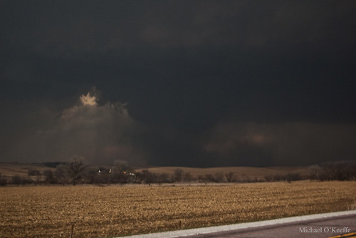
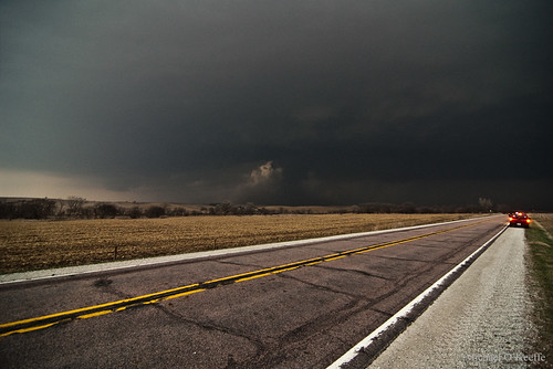
As we entered Onawa we were stopped by a train crossing the road and we quickly looked back to see a classic RFD/clear slot and rapid rotation on the wall cloud. The train moved on in the nick of time and we found a good spot just east of town to watch the now beast of a storm. Inflow continued to be insane and rotation was increasing in the middle of the supercell giving the storm a classic donut hole look. A fire possibly started by lightning was being pulled towards and upwards into the area of rotation just as a debris cloud began churning under the rotation. It quickly grew as a small funnel developed above it. Now I am not sure if this was a tornado or gustnado but for the sake of avoiding a flame war lets just call it a "tornadic" gustnado(?) I don't know what ever it was, it was pretty cool!
Classic structure as the supercell moves over Onawa.

Gustnado just east of Onawa.

After moving east then north then east again we watched the storm cycle and get ready to produce again. The structure was pretty textbook of a strong tornadic supercell with a nice rounded base and several fast moving inflow tails with a nice clear slot on the backside. Soon a small nub funnel was seen to our north with what looked to be a large debris cloud underneath. We filmed it for several minutes as we tried to decide if it was a definite tornado and we were sure it was. We wanted to reposition to the north to get better visibility of the tornado and as we did the debris cloud really grew completely enshrouding the small cone funnel above it in dust. We got a nice view of the tornado once we found our north option and the thing was a large dusty mass. We didn't know it at the time but it was going through Mapleton at this time. We watched it dissipate before repositioned again to our east then north. Once dark fell we took a few lightning pictures and decided to call it a day since we had a 4 hour drive ahead of us and it was already after 8pm. We were a little dissapointed about missing the nighttime tornadofest but what can you do. At least we got to chase! I was more dissapointed about not being east or NE of the tornado like I like to be typically but at least I saw the tornado! We ended up back home around 1am.
Classic structure looking NNW, you can see the Mapleton tornado developing just right of center.

The Mapleton tornado at its peak intensity.

Tornado roping out to our NW.


Great catch!
ReplyDelete